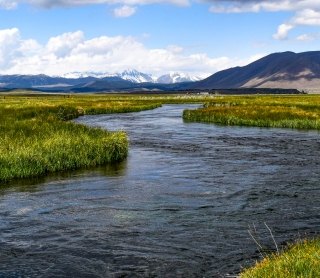
Healthy, sustainable water benefits both people and the environment.
Driven primarily by the federal Clean Water Act, our water resources permitting services focus on compliance with water quality regulations including delineations to support jurisdictional determinations of Waters of the United States, wetland and aquatic resources mitigation, and wastewater and stormwater discharge permitting. We also support clients in implementing other aspects of the Clean Water Act including TMDL development, water quality standards and assessments, and implementation of water quality improvement practices. Our experts bring an interdisciplinary approach to help clients navigate water laws at all levels of government.
Approaching water as a natural resource, our scientists conduct thorough investigations of surface water hydrology, hydrogeology, water quality, and aquatic species and habitats. We develop plans including water supply plans, lake restoration and watershed plans, source vulnerability assessments, riparian enhancement and restoration plans, and recovery plans for threatened, endangered, and sensitive species.
Relevant Services
Field services
- Water Quality Monitoring
- Aquifer Tests
- Sediment Quality Testing
- Hydrographic and Geomorphic Surveys
- Stream-gaging and Weir Design
- California Rapid Assessment Method (CRAM)
- Field delineations of aquatic resources
Permitting and Regulatory Compliance
- Clean Water Act (CWA) Section 404 permitting
- Clean Water Act (CWA) Section 401 Water Quality Certifications
- National Pollutant Discharge Elimination System (NPDES) permits (CWA 402)
- Stormwater Pollution Prevention Plans (SWPPP) (CWA 402)
- Stormwater Inspections
- State water quality and water right permitting support
Planning
- Total Maximum Daily Load (TMDL) Studies
- EPA 319 Watershed Plans
- Water Supply Assessments
- Water Resources Management Plans
- Source Protection Plans
- Integrated Water Financing Plans
- Coastal Resilience Planning
- Restoration Planning
- Water Security
Data analysis and modeling
- Surface Water Quality Statistical Analysis and Modeling
- Hydrologic Modeling
- Groundwater Modeling
- Water Resources Data Management and Storage
- Sediment Modeling
- Risk Assessment Modeling
- Flood Modeling
- Aquatic Species Habitat Modeling
Aquatic Ecology and Fisheries
- Wetland Design, Restoration, and Development
- Wetland Delineation, Enhancement, Mitigation, and Monitoring
- Aquatic and Riparian Community Assessments
- Stream and Riparian Habitat Assessments
- Threatened and Endangered Species Surveys
- Habitat Enhancement and Restoration Design, Implementation, and Monitoring
- Stream Restoration
Other Water Resources Services
- Groundwater Impact Assessment and Mitigation
- Watershed Characterization and Assessment
- Expert Witness Services and Water Rights Negotiations
Project Spotlights
2023
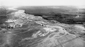
When it Rains, it Pours: How One Man’s Con Set the Stage for a River’s Destruction and Restoration
When San Diego was facing a historic drought in 1915, the city council turned to an unlikely character to solve their crisis: Charles Hatfield, a 40-year-old sewing machine salesman and “rainmaker.”
“What followed in January and early February of 1916 was a downpour — 30 inches of rain by some estimates. Mission Valley flooded. The San Diego River jumped its banks. Farms, homes, bridges and businesses were swept away. Estimates of the deaths range from a dozen to 50.”
2022
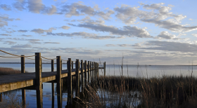
Where the Water Goes: Planning Resilient Coastal Communities in North Carolina
Shaped by rivers, sounds, and the Atlantic Ocean, the coastal regions of North Carolina offer thousands of miles of scenic waterfront. Yet, due to the increasing impacts of climate change, these very waterways threaten the livelihood of a coastline dotted with historic towns and millions of residents. Coastal communities are facing intensifying storms, rising sea levels, and high flood risk.
Twenty-six communities participated in the first phase of North Carolina’s Resilient Coastal Communities Program (RCCP) in 2021 as a framework for counties and municipalities to prepare for coastal hazards through technical and financial support.
2022
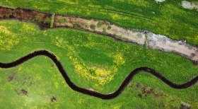
Water, Water, Everywhere: Stream and Wetland Restoration in North Texas
An afternoon thunderstorm rolls across the plains of northern Texas and on the banks of the Red River, the former cattle pastures and agricultural fields at Riverby Ranch slowly begin to fill with water. But there is no cause for concern; in fact, everything is going according to plan. As the North Texas Municipal Water District (NTMWD) creates the area’s first major reservoir in nearly 30 years only a few miles from the Ranch, SWCA’s stream and wetland restoration plans will offset habitat lost to the new lake’s rising waters with a flood of its own – creating protected waterways and wetlands where cattle once grazed.
2022
A Tale of Two Rivers
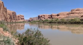
Rivers are the arteries of our earth’s landscape. Nothing matches a river’s abilities to connect our places and spaces and sustain life in, alongside, and even miles away from its course. A river will travel along the path of least resistance, beginning at a high point known as the headwater and ending at its mouth. Depending on its elevation, age, geology, and other factors, a river can make a mad dash through the landscape leaving behind canyons and waterfalls, or it may saunter across the land creating wide floodplains and marshes along its edges.
How do we manage rivers as functioning, sustainable ecosystems while still supporting human needs? It’s a complicated question without easy answers.
2022
Ephemeral but Not Forgotten: SWCA Works to Protect Playas on the Ogallala Aquifer
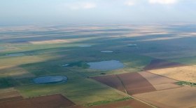
Scattered across the western Great Plains exist an unprotected, yet vital geological feature: playas.
Playas are shallow, depressional, and ephemeral wetlands that provide important ecological benefits to the landscape, such as floodwater retention and water filtration, as well as critical habitat for wildlife. There are over 80,000 playas in the Great Plains region alone, making them the most numerous type of wetland in the region. Serving as the primary water level recharge points for the underlying Ogallala Aquifer, the main water source for the public and for irrigation within the Great Plains, the presence of these playas is essential.


