SWCA is your Partner for Ecosystem Solutions
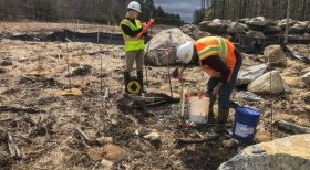
SWCA has served as a valued environmental resources partner to private and public clients in a range of geographies for more than 40 years. Our dedicated ecological restoration and engineering team designs, permits, and builds environmental restoration projects. We have the expertise and the relationships necessary to seamlessly guide clients’ projects from inception to completion. With a strong record of project delivery, our team will help you achieve your project goals through sound science, creative solutions, and technical excellence.
Ecosystems, with their intricate web of interactions, have the inherent ability to buffer against the shocks of a changing climate. They provide a natural solution for the protection of wildlife, and against flooding, coastal degradation, and other disasters. When aligned with climate adaptation policies, ecological restoration can enhance the natural resiliency of communities. Our experts provide support for federal, state, and municipal agencies, private companies, and non-profits in conceptualizing and completing resilience projects, including nature-based solutions, no matter the size.
Associations
• Society for Ecological Restoration (SER)
• Ecological Restoration Business Association (ERBA)
• Society of Wetland Scientists
6100+ Restoration Projects
373 Employees with Restoration Experience
50 # of States Where SWCA has Performed Restoration Work
Relevant Services
Funding
- Funding Source Identification
- Grant proposal preparation
- Technical project support
- Grant application assistance
- Grant eligibility assessment
Planning
- Habitat assessments
- Watershed planning
- Flood analysis
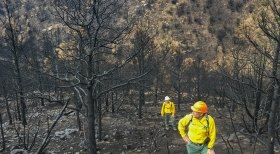
- Post-fire restoration planning
- Wetland assessments and delineations
- Mitigation bank site identification
- Phase I and Phase II Environmental Site Assessments
- Archaeological assessments
Permitting
- National Environmental Policy Act
- Federal and state permitting
- Resource assessments and agency consultations
- Ecological restoration permit streamlining
and statutory/categorical exemptions - Compensatory mitigation plans and designs
Design
- Fluvial geomorphic assessments
- Natural Channel Design (NCD)
- Sediment supply and transport modeling
- Hydrologic and hydraulic modeling
- Fish passage design
- River migration studies
Construction
- Native seeding
- Wetland planting
- Biological Monitoring
- Tree and shrub planting
- Sediment and erosion control measures
- Construction oversight
- Environmental inspections
Maintenance
- Invasive species control
- Biological control of species
- Herbicide application
- Permit compliance
- Integrated Pest Management (IPM) planning
- Natural area stewardship
Monitoring
- Remote instream monitoring
- Surface and groundwater monitoring
- Statistical sampling design
- Vegetation monitoring
- Field surveys
Project Spotlights
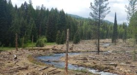
Creek Restoration
Ninemile Creek Restoration Program
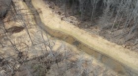
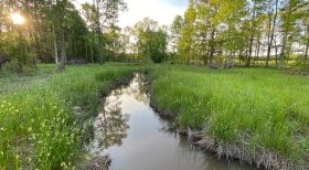
The Ninemile Creek watershed is located in the Middle Clark Fork River watershed in western Montana. Historical placer mining activities significantly altered the morphology of the Ninemile Creek valley. A placer gold boom occurred between 1874 and 1887 and mining with draglines, dredges, hydraulic hoses and sluicing continued until the late 1940s. Alluvial gravels and cobbles were worked into tailings piles ranging from 12 feet to 40 feet in elevation above the stream channel. In 2003, Trout Unlimited and the USDA Forest Service – Lolo National Forest initiated a comprehensive programed aimed to rehabilitate disturbed mining areas in the watershed. River Design Group, now part of SWCA, has served as the engineering firm of record for six phases of restoration encompassing over five miles of stream channel, 60 acres of riparian floodplain, and seven tributary reconnections.

Mitigation Banking
No Stone Left Unturned: Restoring One of the Largest Mitigation Sites in South Carolina
Deep in the woods of South Carolina, native vegetation and aquatic wildlife begin to flourish across 530 acres of a forested watershed. Only a few years ago, this ecosystem looked much different. Generations upon generations of agricultural and outdated land use practices took their toll — degrading miles of streams, eroding large amounts of sediment along the banks, and diminishing aquatic habitat, among other impacts.
The client has long recognized its responsibility to keep forests healthy and wanted to restore these ecologically significant freshwater streams and wetlands within the Lower Broad River Watershed by establishing a mitigation bank on the land, as a part of the company’s sustainability ambitions.
Ecologically significant mitigation and high-quality work were top considerations for the client in selecting a partner. The team of ecological restoration engineers now at SWCA collaborated with the client throughout the entire process, including identifying potential mitigation sites, developing concept designs, providing engineering expertise and permitting support, and overseeing construction and monitoring.
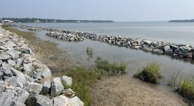
Coastal Restoration
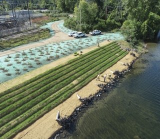
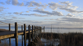
Driving Nature-Based Solutions Forward: Living Shorelines Stabilize Critical Evacuation Route Along North Carolina Coastal Highway
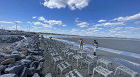
Following a devastating hurricane season in 2018, the North Carolina Department of Transportation (NCDOT) partnered with SWCA to stabilize and restore a particularly vulnerable portion of highway using a living shoreline.
Modeling by NCDOT’s Hydraulics Unit showed that in the likely event of a future hurricane, a 830-foot section of shoreline along NC 24 in Swansboro, North Carolina, could become unstable and lead to the roadway becoming unsafe for residential evacuation. The roadway’s designation as critical infrastructure and a primary evacuation route led NCDOT to emphasize the need for increased resiliency measures.
As lead designer on this project, SWCA detailed plans for the creation of a living shoreline and coastal restoration efforts. Thanks to grant funding from the National Fish and Wildlife Foundation (NFWF), along with funding by NCDOT, these designs have now come to life.
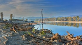
River Restoration
Kootenai River Restoration
The Kootenai River Habitat Restoration Program (KRHRP) is an ecosystem-based restoration effort spanning 55-miles of the Kootenai River in northern Idaho. In 2009, a Master Plan was completed outlining a comprehensive framework for undertaking large-scale habitat restoration to address reach-scale limiting factors related to geomorphology, vegetation, and aquatic habitat. The KRHRP embraces a holistic approach to restoration for addressing the decline of Kootenai River white sturgeon (acipenser transmontanus) caused by Libby Dam operations and a century of land use.
Restoration actions being implemented include side channel enhancement, island/floodplain creation, bank restoration and pool creation. The desired result of the combined projects is a more resilient ecosystem capable of sustaining diverse native plant and animal populations and is tolerant of natural disturbances and altered regimes. SWCA staff have performed planning, design, hydraulic modeling, bid document preparation, construction oversight, and monitoring for eight projects implemented between 2011 and 2016. The Kootenai Tribe is implementing the KRHRP with funding provided by Bonneville Power Administration under the Northwest Power and Conservation Council’s Fish and Wildlife Program.
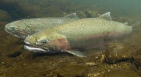
Floodplain Restoration
Strength in Numbers: Purpose-driven team unites to advance restoration plans for a California coastal watershed
Originating in the central mountains of California, the Carmel River flows northwest through redwoods and evergreens, shrubby woodlands, and coastal prairie before emptying into the Pacific Ocean. The Carmel River contributes to a precious coastal watershed but years of agriculture, land development, and storm erosion constrained the river. Near the mouth of the river, residents experienced major flooding events in the 1990s. When the river wasn’t overflowing, it was only a trickle due to overdraft of the aquifer beneath it. Advocates have pushed to restore the floodplain and reduce flood risk for decades. Now, the Rancho Cañada Floodplain Restoration Project, on a unit of the Palo Corona Regional Park, is reviving the river.
Coastal Restoration
Where the Water Goes: Planning Resilient Coastal Communities in North Carolina
Shaped by rivers, sounds, and the Atlantic Ocean, the coastal regions of North Carolina offer thousands of miles of scenic waterfront. Yet, due to the increasing impacts of climate change, these very waterways threaten the livelihood of a coastline dotted with historic towns and millions of residents. Coastal communities are facing intensifying storms, rising sea levels, and high flood risk.
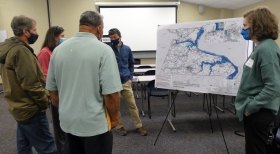
Twenty-six communities participated in the first phase of North Carolina’s Resilient Coastal Communities Program (RCCP) in 2021 as a framework for counties and municipalities to prepare for coastal hazards through technical and financial support.
